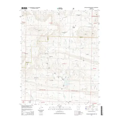
2014 Map of Chickalah Mountain West
USGS Topo · Published 2014About this map
Huckleberry Mtn and the surrounding high ridges of the Ozark National Forest dominate this landscape along the Logan and Yell county line. The map highlights a series of small, rural communities and family homesteads including Gum Tree, Stafford, and Hickory Grove. Local history is deeply embedded in the terrain, with family-named landmarks like Jim White Ridge and Sides Family Cem marking decades of settlement in the valleys.
Find a feature on this map
77 named features on this map. Tap any name to fly to it.
Don’t see what you’re looking for? This feature index may not catch every label — zoom into the map to look around manually.
Map Details
Editions of this 2014 Chickalah Mountain West Map
This is the sole edition of this map. No revisions or reprints were ever made.
Other maps of this area

1879 · Mountain Home
USGS Topo · 1:62,500

1887 · Magazine Mountain #1
USGS Topo · 1:62,500

1887 · Magazine Mountain #4
USGS Topo · 1:62,500

1887 · Magazine Mountain
USGS Topo · 1:62,500

1888 · Dardanelle #2
USGS Topo · 1:62,500

1888 · Dardanelle #3
USGS Topo · 1:62,500

1890 · Magazine Mountain
USGS Topo · 1:125,000

1890 · Dardanelle
USGS Topo · 1:125,000

1956 · Russellville
USGS Topo · 1:250,000
1961 · Scranton
USGS Topo · 1:24,000