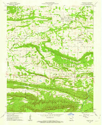
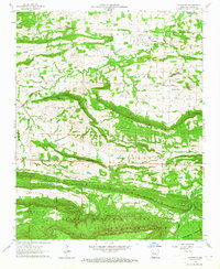
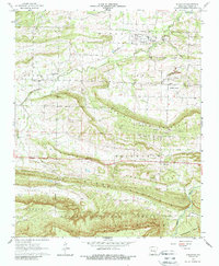
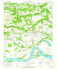
1961 Map of Scranton
USGS Topo · Published 1962About this map
Scranton serves as a focal point in Logan County, situated north of the prominent ridge lines that define this Arkansas landscape. The settlement pattern follows the contours of Prairie View Mountain and Sand Ridge, with numerous family and community landmarks such as Blair Cem, Saint Meinrads Cem, and Stony Point Cem dotting the countryside. Evidence of early infrastructure is clear in the Old Railroad Grade passing through Scranton, signaling the era's transport priorities before modern highway expansion.
Find a feature on this map
43 named features on this map. Tap any name to fly to it.
Don’t see what you’re looking for? This feature index may not catch every label — zoom into the map to look around manually.
Map Details
Editions of this 1961 Scranton Map
3 editions found
Other maps of this area

1879 · Mountain Home
USGS Topo · 1:62,500

1887 · Magazine Mountain #1
USGS Topo · 1:62,500

1887 · Magazine Mountain #4
USGS Topo · 1:62,500

1887 · Magazine Mountain
USGS Topo · 1:62,500

1888 · Dardanelle #2
USGS Topo · 1:62,500

1888 · Dardanelle #3
USGS Topo · 1:62,500

1890 · Magazine Mountain
USGS Topo · 1:125,000

1890 · Dardanelle
USGS Topo · 1:125,000

1956 · Russellville
USGS Topo · 1:250,000
1961 · Coal Hill
USGS Topo · 1:24,000