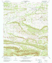
1961 Map of Scranton
USGS Topo · Published 1989About this map
Scranton serves as the primary hub of this Logan County landscape, where small agricultural settlements like Pleasant Hill and Prairie View are scattered across a series of prominent east-west ridges. The topography is defined by the parallel elevations of Prairie Mountain, Sand Ridge, and Pine Ridge, which separate fertile lowlands like Greasy Valley and Saint Louis Valley. This 1961 field-checked survey documents a transition in local industry, showing multiple quarries and a Strip Mine alongside an Old Railroad Grade that speaks to former transit corridors.
Find a feature on this map
43 named features on this map. Tap any name to fly to it.
Don’t see what you’re looking for? This feature index may not catch every label — zoom into the map to look around manually.
Map Details
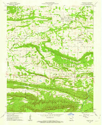
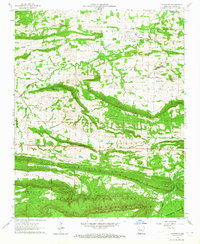
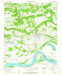
Editions of this 1961 Scranton Map
3 editions found
Other maps of this area

1879 · Mountain Home
USGS Topo · 1:62,500

1887 · Magazine Mountain #1
USGS Topo · 1:62,500

1887 · Magazine Mountain #4
USGS Topo · 1:62,500

1887 · Magazine Mountain
USGS Topo · 1:62,500

1888 · Dardanelle #2
USGS Topo · 1:62,500

1888 · Dardanelle #3
USGS Topo · 1:62,500

1890 · Magazine Mountain
USGS Topo · 1:125,000

1890 · Dardanelle
USGS Topo · 1:125,000

1956 · Russellville
USGS Topo · 1:250,000
1961 · Coal Hill
USGS Topo · 1:24,000