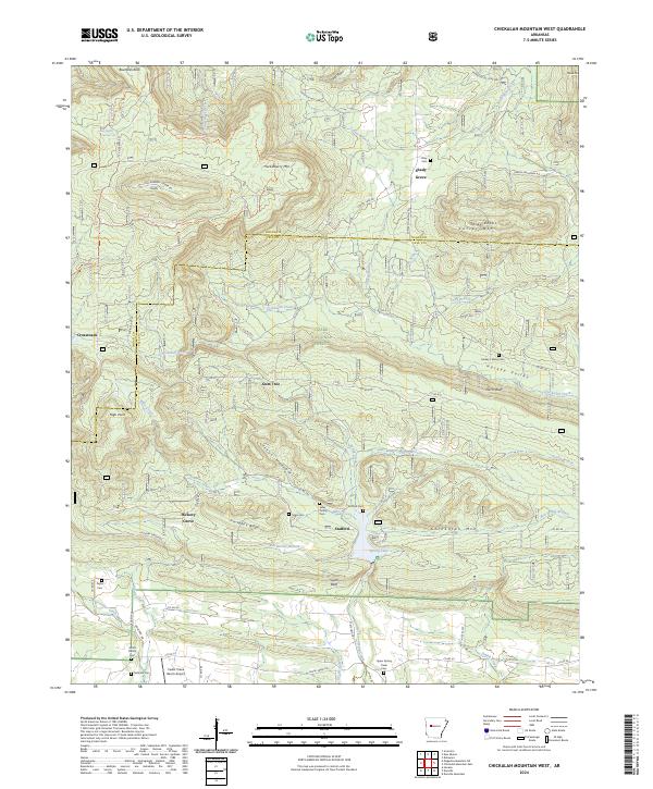
2024 Map of Chickalah Mountain West
USGS Topo · Published 2024About this map
Ozark National Forest lands dominate the northern landscape of this region, where high points like Huckleberry Mtn and Carter Mtn overlook the transitional terrain between the mountains and the river valley. The map documents a scattered rural settlement pattern anchored by small communities such as Gum Tree, Stafford, and Hickory Grove. Local history is deeply etched into the land through numerous family burial sites, including the Sides Family Cem and Smith Family Cem, alongside the Harkey's Valley Cem in the east.
Find a feature on this map
76 named features on this map. Tap any name to fly to it.
Don’t see what you’re looking for? This feature index may not catch every label — zoom into the map to look around manually.
Map Details
Editions of this 2024 Chickalah Mountain West Map
This is the sole edition of this map. No revisions or reprints were ever made.
Other maps of this area

1879 · Mountain Home
USGS Topo · 1:62,500

1887 · Magazine Mountain #1
USGS Topo · 1:62,500

1887 · Magazine Mountain #4
USGS Topo · 1:62,500

1887 · Magazine Mountain
USGS Topo · 1:62,500

1888 · Dardanelle #2
USGS Topo · 1:62,500

1888 · Dardanelle #3
USGS Topo · 1:62,500

1890 · Magazine Mountain
USGS Topo · 1:125,000

1890 · Dardanelle
USGS Topo · 1:125,000

1956 · Russellville
USGS Topo · 1:250,000
1961 · Scranton
USGS Topo · 1:24,000