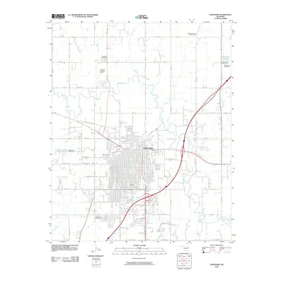
2010 Map of Chickasha
USGS Topo · Published 2010About this map
The Washita River meanders through this Oklahoma landscape, defining the character of Chickasha as it stood at the start of the 2010s. The city's grid is established west of the river, where local history is recorded at Rose Hill Cemetery and Fair Lawn Cemetery. The transport network shows a transition from historical routes like Old US Hwy 62 W and Frisco Ave to modern infrastructure including the Chickasha Municipal Airport.
Find a feature on this map
67 named features on this map. Tap any name to fly to it.
Don’t see what you’re looking for? This feature index may not catch every label — zoom into the map to look around manually.
Map Details
Editions of this 2010 Chickasha Map
This is the sole edition of this map. No revisions or reprints were ever made.
Other maps of this area

1902 · Rush Springs
USGS Topo · 1:125,000

1904 · Chickasha
USGS Topo · 1:125,000

1945 · Anadarko
USGS Topo · 1:62,500

1949 · Cement
USGS Topo · 1:62,500

1949 · Rush Springs
USGS Topo · 1:62,500

1950 · Rush Springs
USGS Topo · 1:62,500

1954 · Oklahoma City
USGS Topo · 1:250,000

1955 · Lawton
USGS Topo · 1:250,000

1955 · Clinton
USGS Topo · 1:250,000

1956 · Laverty
USGS Topo · 1:24,000