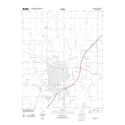
2012 Map of Chickasha
USGS Topo · Published 2012About this map
The Washita River meanders across this landscape, providing a natural backdrop for the dense urban grid of Chickasha and its expanding outlying infrastructure. This 2012 survey highlights the convergence of regional transport and higher education, centered on the Univ Of Science And Arts Of Oklahoma. The town's historical geography is grounded by several significant burial sites, including Fair Lawn Cem to the north and Rose Hill Cem and Fairview Park Cem to the south. Aviation is well-represented by both the Chickasha Municipal Airport and the smaller Redhills Airport. Surrounding the city, a network of county roads like Redding Rd and Gattis Rd serves a terrain drained by numerous smaller waterways such as Salt Cr, Otter Cr, and Line Cr.
Find a feature on this map
118 named features on this map. Tap any name to fly to it.
Don’t see what you’re looking for? This feature index may not catch every label — zoom into the map to look around manually.
Map Details
Editions of this 2012 Chickasha Map
This is the sole edition of this map. No revisions or reprints were ever made.
Other maps of this area

1902 · Rush Springs
USGS Topo · 1:125,000

1904 · Chickasha
USGS Topo · 1:125,000

1945 · Anadarko
USGS Topo · 1:62,500

1949 · Cement
USGS Topo · 1:62,500

1949 · Rush Springs
USGS Topo · 1:62,500

1950 · Rush Springs
USGS Topo · 1:62,500

1954 · Oklahoma City
USGS Topo · 1:250,000

1955 · Lawton
USGS Topo · 1:250,000

1955 · Clinton
USGS Topo · 1:250,000

1956 · Laverty
USGS Topo · 1:24,000