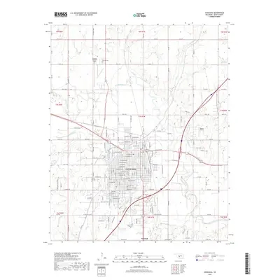
2018 Map of Chickasha
USGS Topo · Published 2018About this map
Chickasha sits as the central hub of Grady County, anchored by a dense street grid that includes major thoroughfares like W Washington Ave and Frisco Ave. This 2018 survey illustrates the expansion of the city toward the Washita River and the neighboring community of Ninnekah to the south. The landscape is a mix of urban development and rural infrastructure, punctuated by local landmarks like the Chickasha Municipal Airport and Redhills Airport.
Find a feature on this map
84 named features on this map. Tap any name to fly to it.
Don’t see what you’re looking for? This feature index may not catch every label — zoom into the map to look around manually.
Map Details
Editions of this 2018 Chickasha Map
This is the sole edition of this map. No revisions or reprints were ever made.
Other maps of this area

1902 · Rush Springs
USGS Topo · 1:125,000

1904 · Chickasha
USGS Topo · 1:125,000

1945 · Anadarko
USGS Topo · 1:62,500

1949 · Cement
USGS Topo · 1:62,500

1949 · Rush Springs
USGS Topo · 1:62,500

1950 · Rush Springs
USGS Topo · 1:62,500

1954 · Oklahoma City
USGS Topo · 1:250,000

1955 · Lawton
USGS Topo · 1:250,000

1955 · Clinton
USGS Topo · 1:250,000

1956 · Laverty
USGS Topo · 1:24,000