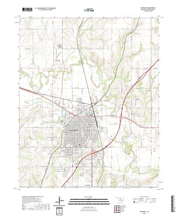
2022 Map of Chickasha
USGS Topo · Published 2022About this map
Chickasha serves as a prominent regional center along the winding Washita River, which snakes through the landscape alongside tributaries like Salt Cr and Line Cr. The city's grid is densely populated with historic institutional landmarks, most notably the University of Science and Arts of Oklahoma and the Grady County Courthouse. This 2022 survey captures the convergence of significant regional infrastructure, from the Chickasha Municipal Airport in the northwest to the extensive network of numbered county roads like Co RD 1310 and e1330 RD that define the surrounding agricultural sections. The local landscape is punctuated by established resting places, including Fair Lawn Cem to the north and Rose Hill Cem near the university, while the smaller settlement of Ninnekah sits at the southern edge of the quadrangle along the rail corridor.
Find a feature on this map
85 named features on this map. Tap any name to fly to it.
Don’t see what you’re looking for? This feature index may not catch every label — zoom into the map to look around manually.
Map Details
Editions of this 2022 Chickasha Map
This is the sole edition of this map. No revisions or reprints were ever made.
Other maps of this area

1902 · Rush Springs
USGS Topo · 1:125,000

1904 · Chickasha
USGS Topo · 1:125,000

1945 · Anadarko
USGS Topo · 1:62,500

1949 · Cement
USGS Topo · 1:62,500

1949 · Rush Springs
USGS Topo · 1:62,500

1950 · Rush Springs
USGS Topo · 1:62,500

1954 · Oklahoma City
USGS Topo · 1:250,000

1955 · Lawton
USGS Topo · 1:250,000

1955 · Clinton
USGS Topo · 1:250,000

1956 · Laverty
USGS Topo · 1:24,000