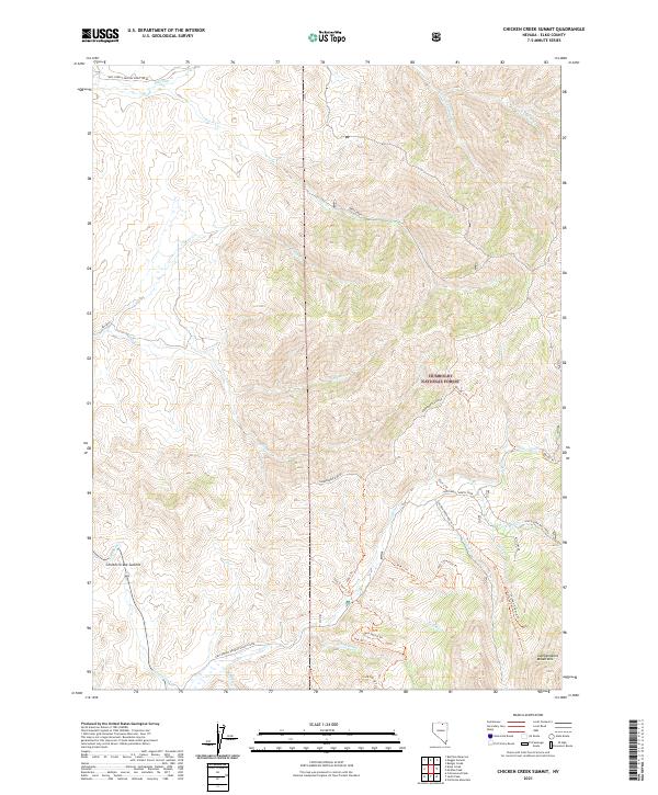
2021 Map of Chicken Creek Summit
USGS Topo · Published 2021About this map
Humboldt National Forest encompasses the high-altitude terrain of the Independence Mountains in this modern survey. The landscape is defined by a dense network of watercourses and primitive trails, such as the Chicken Creek Route and Jack Trl, which navigate the steep drainage basins of South Fork Mill Creek and Frost Creek. The presence of numerous specialized trail spurs, including Jack 3 Spur A Trl and Chicken S Spur A Trl, suggests a region heavily utilized for backcountry recreation and forest management. The highest elevations center around the Chicken Creek Summit, while the lower reaches show access via Independence Drive and Natl Forest Develop Road 165 Rd, providing a detailed look at the contemporary infrastructure within this protected Nevada wilderness.
Find a feature on this map
43 named features on this map. Tap any name to fly to it.
Don’t see what you’re looking for? This feature index may not catch every label — zoom into the map to look around manually.
Map Details
Editions of this 2021 Chicken Creek Summit Map
This is the sole edition of this map. No revisions or reprints were ever made.
Other maps of this area

1955 · McDermitt
USGS Topo · 1:250,000

1955 · Wells
USGS Topo · 1:250,000

1956 · Tuscarora
USGS Topo · 1:62,500

1956 · Bull Run
USGS Topo · 1:62,500

1956 · Wild Horse
USGS Topo · 1:62,500

1958 · Wells
USGS Topo · 1:250,000

1959 · McDermitt
USGS Topo · 1:250,000

1961 · Wells
USGS Topo · 1:250,000

1971 · California Mtn.
USGS Topo · 1:24,000
1981 · Jarbidge Mts
USGS Topo · 1:100,000