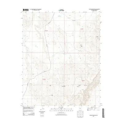
2013 Map of Chicken Mountain
USGS Topo · Published 2013About this map
Pie Ranch stands as a primary point of interest in this high-desert landscape, situated along the path of Indian Rte 55 as it winds through the central valley. The topography is dominated by dramatic elevations, ranging from the volcanic profiles of Cerro Alesna to the broad heights of Mesa Cimarron and the Sierra Lucero range. This arid region's reliance on water management is evident in the numerous earthen tanks and windmills scattered throughout the terrain, including Mule Tank, Rough and Muddy Tank, and Virgils Windmill. Drainage patterns are clearly marked by substantial features like Chicken Mountain Draw and Hippy Draw, which channel seasonal runoff from the surrounding peaks. The map details a remote pastoral and ranching environment where the land is defined more by its natural landmarks and water sources than by dense settlement.
Find a feature on this map
30 named features on this map. Tap any name to fly to it.
Don’t see what you’re looking for? This feature index may not catch every label — zoom into the map to look around manually.
Map Details
Editions of this 2013 Chicken Mountain Map
This is the sole edition of this map. No revisions or reprints were ever made.
Other maps of this area

1917 · Cerro Verde
USGS Topo · 1:125,000

1954 · Socorro
USGS Topo · 1:250,000

1956 · South Garcia
USGS Topo · 1:62,500

1956 · Mesa Aparejo
USGS Topo · 1:62,500

1958 · Socorro
USGS Topo · 1:250,000

1960 · Cerro Verde
USGS Topo · 1:24,000

1961 · Marmon Ranch
USGS Topo · 1:24,000

1962 · Socorro
USGS Topo · 1:250,000

1964 · Field Ranch
USGS Topo · 1:24,000
1964 · Cerro Del Oro
USGS Topo · 1:24,000