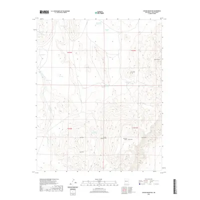
2020 Map of Chicken Mountain
USGS Topo · Published 2020About this map
Cerro Alesna stands as a prominent topographical focal point in this portion of the New Mexico high desert, surrounded by a complex system of water management features essential for ranching and land use. The presence of numerous named catchments, such as Chicken Mountain Tank, Mule Tank, and Cerro Alesna Tanks, indicates a landscape adapted for livestock in an arid environment. The terrain is defined by dramatic elevations including Horse Mtn and the western edge of the Sierra Lucero.
Find a feature on this map
25 named features on this map. Tap any name to fly to it.
Don’t see what you’re looking for? This feature index may not catch every label — zoom into the map to look around manually.
Map Details
Editions of this 2020 Chicken Mountain Map
This is the sole edition of this map. No revisions or reprints were ever made.
Other maps of this area

1917 · Cerro Verde
USGS Topo · 1:125,000

1954 · Socorro
USGS Topo · 1:250,000

1956 · South Garcia
USGS Topo · 1:62,500

1956 · Mesa Aparejo
USGS Topo · 1:62,500

1958 · Socorro
USGS Topo · 1:250,000

1960 · Cerro Verde
USGS Topo · 1:24,000

1961 · Marmon Ranch
USGS Topo · 1:24,000

1962 · Socorro
USGS Topo · 1:250,000

1964 · Field Ranch
USGS Topo · 1:24,000
1964 · Cerro Del Oro
USGS Topo · 1:24,000