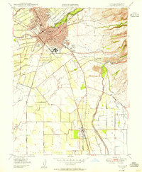
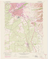
1948 Map of Chico
USGS Topo · Published 1955About this map
The State College campus and the industrial grounds of the Diamond Match Factory define the post-war landscape of Chico. This survey reveals a city expanding along Vallombrosa Ave and Esplanade, while maintaining its connection to the extensive Bidwell Park greenery along Big Chico Creek. To the south, the settlements of Barber and Chapmantown stand near the rail corridor, where the Southern Pacific and Sacramento Northern railroads intersect at Stirling Junction.
Find a feature on this map
40 named features on this map. Tap any name to fly to it.
Don’t see what you’re looking for? This feature index may not catch every label — zoom into the map to look around manually.
Map Details
Editions of this 1948 Chico Map
5 editions found
Other maps of this area

1891 · Chico
USGS Topo · 1:125,000

1893 · Chico
USGS Topo · 1:125,000

1895 · Chico
USGS Topo · 1:125,000

1912 · Dry Creek
USGS Topo · 1:31,680

1912 · Durham
USGS Topo · 1:31,680

1912 · Nord
USGS Topo · 1:31,680

1912 · Chico Landing
USGS Topo · 1:31,680

1912 · Nelson
USGS Topo · 1:31,680

1912 · Keefers
USGS Topo · 1:31,680

1912 · Clear Creek
USGS Topo · 1:31,680