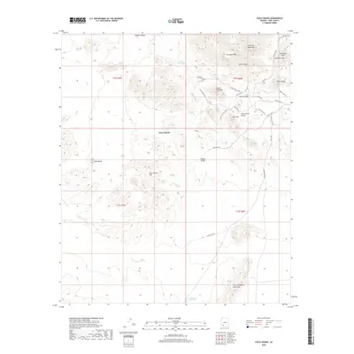
2018 Map of Chico Shunie
USGS Topo · Published 2018About this map
Chico Shunie sits at the heart of a high desert landscape defined by the convergence of the Little Ajo Mountains and the John the Baptist Mountains. This 2018 survey reveals a terrain dominated by significant peaks, including Cardigan Peak, North Ajo Peak, and Ajo Peak. The water management patterns of the region are evident through features like Valentine Well, Camerons Stock Tank, and Little Tule Tank, which are essential for survival in the arid environment south of the Chico Shunie Hills. Modern influences appear in the form of playfully named roads and trails such as Roller Coaster, Yeti Crossing, and Hello Mexico. To the west, Tepee Butte stands as a distinct landmark against the drainage of Daniels Arroyo, illustrating the complex network of dry washes that channel seasonal rains through the Chico Shunie Arroyo toward the western basins.
Find a feature on this map
39 named features on this map. Tap any name to fly to it.
Don’t see what you’re looking for? This feature index may not catch every label — zoom into the map to look around manually.
Map Details
Editions of this 2018 Chico Shunie Map
This is the sole edition of this map. No revisions or reprints were ever made.
Other maps of this area

1932 · Ajo
USGS Topo · 1:62,500

1934 · Ajo
USGS Topo · 1:62,500

1953 · Ajo
USGS Topo · 1:250,000

1957 · Ajo
USGS Topo · 1:250,000

1958 · Ajo
USGS Topo · 1:250,000

1962 · Ajo
USGS Topo · 1:250,000

1963 · Ajo
USGS Topo · 1:250,000

1963 · Ajo
USGS Topo · 1:62,500

1963 · Kino Peak
USGS Topo · 1:62,500

1964 · Growler Peak
USGS Topo · 1:62,500