
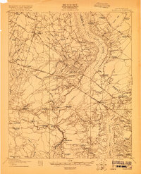
1920 Map of Chicora
USGS Topo · Published 1920About this map
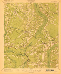
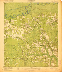
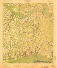
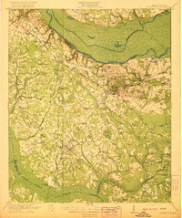
Santee River and the sprawling Santee Swamp dominate this landscape just north of the Lowcountry, surveyed shortly after the Great War. The map documents a rural society deeply rooted in its geography, with life concentrated along high ground like Jackson Ridge and the winding Congaree Road. One of the most significant landmarks is the Francis Marion Tomb, situated near the Oakland Club and the intricate networks of Cahusac Lake and Couturier Lake.
Find a feature on this map
83 named features on this map. Tap any name to fly to it.
Don’t see what you’re looking for? This feature index may not catch every label — zoom into the map to look around manually.
Map Details
Editions of this 1920 Chicora Map
This is the sole edition of this map. No revisions or reprints were ever made.
Other maps of this area

1919 · Summerville
USGS Topo · 1:48,000
1919 · Ridgeville
USGS Topo · 1:48,000

1919 · Cordesville
USGS Topo · 1:48,000

1920 · Eutawville
USGS Topo · 1:48,000

1920 · Manning
USGS Topo · 1:48,000
1920 · Ridgeville
USGS Topo · 1:62,500

1920 · Summerville
USGS Topo · 1:62,500
1921 · Chicora
USGS Topo · 1:62,500
1921 · Manning
USGS Topo · 1:62,500
1921 · Eutawville
USGS Topo · 1:62,500