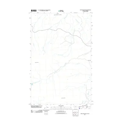
2011 Map of Chief Mountain
USGS Topo · Published 2011About this map
Chief Mountain and Sherburne Peak dominate this landscape along the international border between the Canada United States of America boundary. The area is defined by a complex network of high-altitude drainages, including the various branches of Lee Creek, such as Middle Fork Lee Creek and East Fork Lee Creek, which flow northward toward the border. To the south, Otatso Creek carves through the terrain below Sandy Ridge, eventually leading toward the waters of Slide Lake. The map reveals a wilderness area largely devoid of major human infrastructure, with the primary features being the natural landmarks and watercourses like Jule Creek and Kennedy Creek. This 2011 survey captures the hydrological patterns of the northern Rockies at a time of continued environmental monitoring in Glacier County.
Find a feature on this map
12 named features on this map. Tap any name to fly to it.
Don’t see what you’re looking for? This feature index may not catch every label — zoom into the map to look around manually.
Map Details
Editions of this 2011 Chief Mountain Map
This is the sole edition of this map. No revisions or reprints were ever made.
Other maps of this area

1901 · Browning
USGS Topo · 1:125,000

1903 · Browning
USGS Topo · 1:125,000

1904 · Chief Mountain
USGS Topo · 1:125,000

1938 · Chief Mountain
USGS Topo · 1:125,000

1960 · Cut Bank
USGS Topo · 1:250,000

1963 · Cut Bank
USGS Topo · 1:250,000

1964 · Cut Bank
USGS Topo · 1:250,000

1968 · Gable Mountain
USGS Topo · 1:24,000

1968 · Babb
USGS Topo · 1:24,000
1968 · Chief Mountain
USGS Topo · 1:24,000