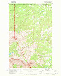
1968 Map of Chief Mountain
USGS Topo · Published 1972About this map
Glacier National Park dominates the western portion of this 1968 survey, meeting the Blackfeet Indian Reservation Boundary at the foot of the iconic Chief Mountain. The landscape is defined by the massive drainage systems of Lee Creek and Otatso Creek, which flow through the northeastern corner of the park toward the Canada United States border. This era of management is marked by the presence of back-country infrastructure, including Patrol Cabin locations and the Gable Pass Trail. High alpine features such as Yellow Mountain and Sherburne Peak rise above the high-altitude Slide Lake, while the Chief Mountain International Highway provides the primary vehicular artery through this wilderness crossing into the Lethbridge District.
Find a feature on this map
22 named features on this map. Tap any name to fly to it.
Don’t see what you’re looking for? This feature index may not catch every label — zoom into the map to look around manually.
Map Details
Editions of this 1968 Chief Mountain Map
3 editions found
Other maps of this area

1901 · Browning
USGS Topo · 1:125,000

1903 · Browning
USGS Topo · 1:125,000

1904 · Chief Mountain
USGS Topo · 1:125,000

1938 · Chief Mountain
USGS Topo · 1:125,000

1960 · Cut Bank
USGS Topo · 1:250,000

1963 · Cut Bank
USGS Topo · 1:250,000

1964 · Cut Bank
USGS Topo · 1:250,000

1968 · Gable Mountain
USGS Topo · 1:24,000

1968 · Babb
USGS Topo · 1:24,000
1968 · Lake Sherburne
USGS Topo · 1:24,000