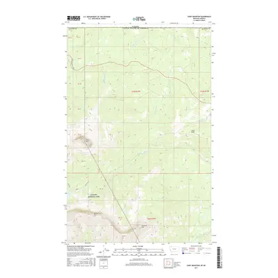
2017 Map of Chief Mountain
USGS Topo · Published 2017About this map
Chief Mtn dominates this high-altitude landscape along the northern border of Glacier National Park, where the United States meets Canada. The terrain is defined by dramatic elevation changes, from the sharp crest of Sandy Ridge to the deep drainage basins of Otatso Creek and Kennedy Cr. Modern access is provided by the Chief Mountain Highway, which snakes through the northern sections of the map, providing a primary route through the high country. The map illustrates a complex network of glacial and alpine features, including Sherburne Peak, Yellow Mtn, and the remote waters of Slide Lake. This 2017 survey captures the precise intersection of international and protected park boundaries, providing a detailed look at the hydrology of the Lee Cr forks as they flow toward the border.
Find a feature on this map
29 named features on this map. Tap any name to fly to it.
Don’t see what you’re looking for? This feature index may not catch every label — zoom into the map to look around manually.
Map Details
Editions of this 2017 Chief Mountain Map
This is the sole edition of this map. No revisions or reprints were ever made.
Other maps of this area

1901 · Browning
USGS Topo · 1:125,000

1903 · Browning
USGS Topo · 1:125,000

1904 · Chief Mountain
USGS Topo · 1:125,000

1938 · Chief Mountain
USGS Topo · 1:125,000

1960 · Cut Bank
USGS Topo · 1:250,000

1963 · Cut Bank
USGS Topo · 1:250,000

1964 · Cut Bank
USGS Topo · 1:250,000

1968 · Gable Mountain
USGS Topo · 1:24,000

1968 · Babb
USGS Topo · 1:24,000
1968 · Chief Mountain
USGS Topo · 1:24,000