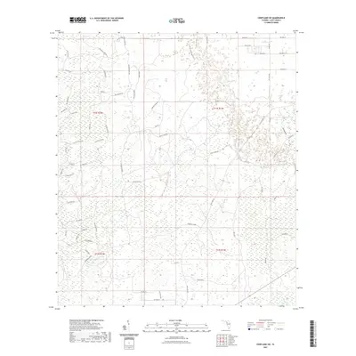
2021 Map of Chiefland SW
USGS Topo · Published 2021About this map
Low-lying hammocks and a dense network of logging and access roads define this coastal-adjacent portion of Levy County in the early 2020s. Gull Hammock and the waters of Kelly Cr anchor the southeastern corner of the quadrangle, illustrating the saturated, marshy landscape characteristic of Florida's Nature Coast region. The interior is partitioned by long-established transit corridors such as the Usher Mainline and Camp Grade, reflecting a landscape managed for timber and rural access. Family-named and descriptive routes like Marshburn Rd, Gopher Ridge Rd, and Little Green House Rd weave through the township sections of T13S and T14S. The map provides a detailed view of the rural infrastructure between the larger Gulf-side wetlands and the upland interior, capturing the exact configuration of private and local roads during a period of continued regional consistency.
Find a feature on this map
65 named features on this map. Tap any name to fly to it.
Don’t see what you’re looking for? This feature index may not catch every label — zoom into the map to look around manually.
Map Details
Editions of this 2021 Chiefland SW Map
This is the sole edition of this map. No revisions or reprints were ever made.
Other maps of this area

1954 · Chiefland
USGS Topo · 1:24,000

1954 · Otter Creek
USGS Topo · 1:24,000

1954 · Manatee Springs
USGS Topo · 1:24,000

1954 · Chiefland SW
USGS Topo · 1:24,000

1954 · Vista
USGS Topo · 1:24,000

1954 · East Pass
USGS Topo · 1:24,000

1954 · Gainesville
USGS Topo · 1:250,000

1955 · Cedar Key
USGS Topo · 1:24,000

1955 · Waccasassa Bay
USGS Topo · 1:24,000

1955 · Sumner
USGS Topo · 1:24,000