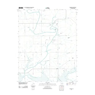
2013 Map of Childers
USGS Topo · Published 2013About this map
The Verdigris River serpentines through this portion of Nowata County, creating a landscape defined by dramatic oxbows and alluvial plains. Near the sharp northern bend at Hancock Bend, the terrain rises to Tully Hill, while the surrounding section lines are marked by several family and community burial grounds, including Wells Cem and Buffalo Cem. These cemeteries, often situated on slightly elevated ground away from the flood-prone riverbanks, provide a significant spatial record of the area's rural genealogy.
Find a feature on this map
44 named features on this map. Tap any name to fly to it.
Don’t see what you’re looking for? This feature index may not catch every label — zoom into the map to look around manually.
Map Details
Editions of this 2013 Childers Map
This is the sole edition of this map. No revisions or reprints were ever made.
Other maps of this area

1901 · Nowata
USGS Topo · 1:125,000

1901 · Vinita
USGS Topo · 1:125,000

1913 · Vinita
USGS Topo · 1:125,000

1914 · Nowata
USGS Topo · 1:125,000

1954 · Tulsa
USGS Topo · 1:250,000

1958 · Tulsa
USGS Topo · 1:250,000

1963 · Tulsa
USGS Topo · 1:250,000
1972 · Elliott
USGS Topo · 1:24,000

1972 · Nowata West
USGS Topo · 1:24,000
1972 · Sanders
USGS Topo · 1:24,000