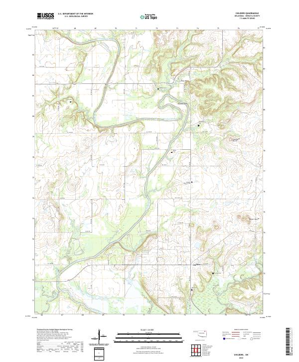
2022 Map of Childers
USGS Topo · Published 2022About this map
The Verdigris River serpentines through this portion of Nowata County, creating dramatic topographic shifts at Hancock Bend and fueling several oxbow-style lakes including French Lake and Stone Lake. The landscape is defined by the tension between the river valley and the rising elevations of the Cherokee Nation land, punctuated by distinctive formations like Steamboat Mound and Rogers Mound.
Find a feature on this map
41 named features on this map. Tap any name to fly to it.
Don’t see what you’re looking for? This feature index may not catch every label — zoom into the map to look around manually.
Map Details
Editions of this 2022 Childers Map
This is the sole edition of this map. No revisions or reprints were ever made.
Other maps of this area

1901 · Nowata
USGS Topo · 1:125,000

1901 · Vinita
USGS Topo · 1:125,000

1913 · Vinita
USGS Topo · 1:125,000

1914 · Nowata
USGS Topo · 1:125,000

1954 · Tulsa
USGS Topo · 1:250,000

1958 · Tulsa
USGS Topo · 1:250,000

1963 · Tulsa
USGS Topo · 1:250,000
1972 · Elliott
USGS Topo · 1:24,000

1972 · Nowata West
USGS Topo · 1:24,000
1972 · Sanders
USGS Topo · 1:24,000