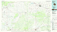
1986 Map of Childress
USGS Topo · Published 1986About this map
The rolling plains and breaks of West Texas are defined here by the intricate drainage systems of the Pease River and Red River forks. At the center of the region's conservation and ranching history, the Matador Wildlife Management Area occupies a significant portion of the landscape, while Caprock Canyon State Park marks the transition to the rugged escarpment in the northwest. Local life centers on established hubs like Matador, where the Matador Cem preserves generations of community history, and Paducah, which serves as a junction for local roads.
Find a feature on this map
117 named features on this map. Tap any name to fly to it.
Don’t see what you’re looking for? This feature index may not catch every label — zoom into the map to look around manually.
Map Details
Editions of this 1986 Childress Map
2 editions found
Other maps of this area

1927 · Quanah 3-b
USGS Topo · 1:48,000

1932 · Vivian
USGS Topo · 1:62,500

1954 · Lubbock
USGS Topo · 1:250,000

1954 · Plainview
USGS Topo · 1:250,000

1954 · Wichita Falls
USGS Topo · 1:250,000

1955 · Lawton
USGS Topo · 1:250,000

1958 · Wichita Falls
USGS Topo · 1:250,000

1958 · Plainview
USGS Topo · 1:250,000

1960 · Goodlett
USGS Topo · 1:62,500

1960 · Teacup Mountain
USGS Topo · 1:62,500