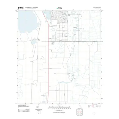
2012 Map of Childs
USGS Topo · Published 2012About this map
Archbold and the research-focused landscape surrounding it dominate this Highlands County survey. The map records the network of rural roads and environmental features that define this part of the Lake Wales Ridge, including the distinct Archbold Tower. Water bodies such as Lake Placid, Grassy Lake, and Lake Annie punctuate the sandy terrain, while the course of Hickory Br flows through the southern reaches. Small settlements and named locales like Hicoria, Bairs Den, and Bear Hollow reflect the scattered residential and scientific hubs of the region. The grid of roads, including Old State Road 8 and Hickory Branch RD, provides a window into the accessibility of this specialized interior Florida landscape during the early 21st century.
Find a feature on this map
95 named features on this map. Tap any name to fly to it.
Don’t see what you’re looking for? This feature index may not catch every label — zoom into the map to look around manually.
Map Details
Editions of this 2012 Childs Map
This is the sole edition of this map. No revisions or reprints were ever made.
Other maps of this area

1952 · Lake Placid
USGS Topo · 1:24,000

1953 · Brighton NW
USGS Topo · 1:24,000

1953 · Lake June In Winter
USGS Topo · 1:24,000

1953 · Brighton SW
USGS Topo · 1:24,000

1953 · Venus NW
USGS Topo · 1:24,000

1953 · Basinger SW
USGS Topo · 1:24,000

1953 · Childs
USGS Topo · 1:24,000

1956 · Fort Pierce
USGS Topo · 1:250,000

1957 · Venus
USGS Topo · 1:24,000

1957 · Venus SW
USGS Topo · 1:24,000