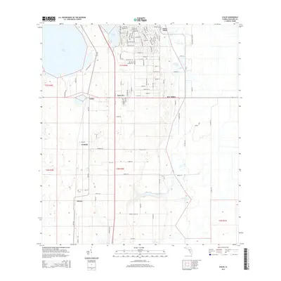
2015 Map of Childs
USGS Topo · Published 2015About this map
Hicoria and Childs anchor this Highlands County interior, where a network of localized settlements sits amidst the sandy ridges and wetlands characteristic of the Florida peninsula. The landscape is defined by its water systems, including the eastern reach of Lake Placid and the winding course of Hickory Branch. The central corridor is dominated by the Archbold biological research area and its associated road network, such as Archbold Rd, providing a detailed look at land use in this specific ecological zone. Transport patterns follow historical routes, with Old SR-8 serving as a primary north-south artery connecting smaller locales like Bairs Den and Bear Hollow. The map also details the parceling of the land into townships, including t38s r30e, illustrating the intersection of residential development and preserved natural spaces such as Parker Island.
Find a feature on this map
101 named features on this map. Tap any name to fly to it.
Don’t see what you’re looking for? This feature index may not catch every label — zoom into the map to look around manually.
Map Details
Editions of this 2015 Childs Map
This is the sole edition of this map. No revisions or reprints were ever made.
Other maps of this area

1952 · Lake Placid
USGS Topo · 1:24,000

1953 · Brighton NW
USGS Topo · 1:24,000

1953 · Lake June In Winter
USGS Topo · 1:24,000

1953 · Brighton SW
USGS Topo · 1:24,000

1953 · Venus NW
USGS Topo · 1:24,000

1953 · Basinger SW
USGS Topo · 1:24,000

1953 · Childs
USGS Topo · 1:24,000

1956 · Fort Pierce
USGS Topo · 1:250,000

1957 · Venus
USGS Topo · 1:24,000

1957 · Venus SW
USGS Topo · 1:24,000