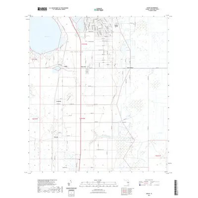
2021 Map of Childs
USGS Topo · Published 2021About this map
Lake Wales Ridge dominates the central topography of this Highlands County region, where the high ground transitions into the wetlands and citrus groves of south-central Florida. The settlement of Childs sits at a strategic junction near Lake Annie, serving as a gateway to the Archbold biological research area. Further south, the map documents the area of Hicoria, a name tied to the region's historical timber and turpentine industries. The landscape is a complex mosaic of sandy uplands and low-lying water bodies, including Lake Placid and Grassy Lake in the north, and the drainage of Hickory Branch leading toward Bay Swamp. This 2021 survey details the modern road network, from Old State Hwy 8 to rural tracks like Womble Rd, illustrating how contemporary land use and conservation efforts interface with early 20th-century settlement patterns.
Find a feature on this map
98 named features on this map. Tap any name to fly to it.
Don’t see what you’re looking for? This feature index may not catch every label — zoom into the map to look around manually.
Map Details
Editions of this 2021 Childs Map
This is the sole edition of this map. No revisions or reprints were ever made.
Other maps of this area

1952 · Lake Placid
USGS Topo · 1:24,000

1953 · Brighton NW
USGS Topo · 1:24,000

1953 · Lake June In Winter
USGS Topo · 1:24,000

1953 · Brighton SW
USGS Topo · 1:24,000

1953 · Venus NW
USGS Topo · 1:24,000

1953 · Basinger SW
USGS Topo · 1:24,000

1953 · Childs
USGS Topo · 1:24,000

1956 · Fort Pierce
USGS Topo · 1:250,000

1957 · Venus
USGS Topo · 1:24,000

1957 · Venus SW
USGS Topo · 1:24,000