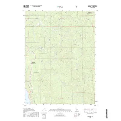
2018 Map of Childs Hill
USGS Topo · Published 2018About this map
Redwood National Park dominates the western coastal reach of this Del Norte County landscape, where the land meets the Pacific Ocean near the mouth of Damnation Cr. The interior is defined by steep, timbered ridges and a dense network of forest management roads and spurs, including Rock Creek Rd and Baldhill Spur Rd, which crisscross the high ground of Childs Hill and Bald Hill. This 2018 survey reveals the complex drainage systems of the North Coast, from the Mill Cr watershed to the W Fork Hunter Cr and the secluded Bummer Lake. The map illustrates the intersection of conservation and commercial timber history, with the Six Rivers National Forest bordering the national park and several historic trails like the Mill Creek Horse Trail and Bense Trl providing access through the rugged terrain.
Find a feature on this map
71 named features on this map. Tap any name to fly to it.
Don’t see what you’re looking for? This feature index may not catch every label — zoom into the map to look around manually.
Map Details
Editions of this 2018 Childs Hill Map
This is the sole edition of this map. No revisions or reprints were ever made.
Other maps of this area

1922 · Preston Peak
USGS Topo · 1:125,000

1929 · Crescent City
USGS Topo · 1:125,000

1945 · Ship Mountain
USGS Topo · 1:62,500

1945 · Gasquet
USGS Topo · 1:62,500

1945 · Point St. George
USGS Topo · 1:62,500

1945 · Requa
USGS Topo · 1:62,500

1948 · Weed
USGS Topo · 1:250,000

1949 · Eureka
USGS Topo · 1:250,000

1950 · Weed
USGS Topo · 1:250,000

1951 · Gasquet
USGS Topo · 1:62,500