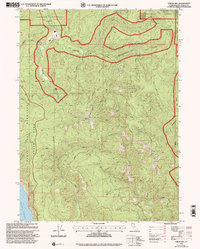
1997 Map of Childs Hill
USGS Topo · Published 2001About this map
Redwood National Park and the Del Norte Coast Redwoods State Park dominate this coastal landscape, where the terrestrial wilderness meets the Pacific Ocean along the western edge. This 1997 revision shows a complex network of administrative boundaries, including the Six National Forest and the Smith River National Recreation Area, protecting the drainages of the East Fork Smith River and Mill Creek. The terrain is defined by prominent elevations such as Childs Hill and Bald Hill, which overlook a dense system of tributary waters including Wilson Creek, Hunter Creek, and Nickel Creek. To the northeast, the remote Bummer Lake sits near the headwaters of Bummer Lake Creek, highlighting the protected interior of the Smith River watershed. This survey captures the region's transition between state and federal management just before the turn of the millennium.
Find a feature on this map
19 named features on this map. Tap any name to fly to it.
Don’t see what you’re looking for? This feature index may not catch every label — zoom into the map to look around manually.
Map Details
Editions of this 1997 Childs Hill Map
This is the sole edition of this map. No revisions or reprints were ever made.
Other maps of this area

1922 · Preston Peak
USGS Topo · 1:125,000

1929 · Crescent City
USGS Topo · 1:125,000

1945 · Ship Mountain
USGS Topo · 1:62,500

1945 · Gasquet
USGS Topo · 1:62,500

1945 · Point St. George
USGS Topo · 1:62,500

1945 · Requa
USGS Topo · 1:62,500

1948 · Weed
USGS Topo · 1:250,000

1949 · Eureka
USGS Topo · 1:250,000

1950 · Weed
USGS Topo · 1:250,000

1951 · Gasquet
USGS Topo · 1:62,500