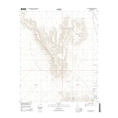
2014 Map of Childs Mountain
USGS Topo · Published 2014About this map
Childs Mountain dominates the central landscape of this western Pima County region, its volcanic-formed ridges and deep canyons defining the local geography. To the south, the terrain descends toward the Little Aja Mountains, while the northeast is characterized by the broad floor of Childs Valley. The settlement pattern is concentrated in the southeastern corner, where the community of Ajo and the neighboring locale of Gibson sit at the base of the highlands. This area, known for its mining heritage, is documented here through a dense network of residential streets including W Rasmussen Rd and N Thompson Ave. Drainage patterns, vital in this arid environment, are traced through the Gibson Arroyo and the seasonal waters of Tenmile Wash, which runs parallel to the Az 85 corridor. Notable landmarks such as Pozo Salado provide a glimpse into the distribution of water resources that historically supported life in the Sonoran desert.
Find a feature on this map
26 named features on this map. Tap any name to fly to it.
Don’t see what you’re looking for? This feature index may not catch every label — zoom into the map to look around manually.
Map Details
Editions of this 2014 Childs Mountain Map
This is the sole edition of this map. No revisions or reprints were ever made.
Other maps of this area

1932 · Ajo
USGS Topo · 1:62,500

1934 · Ajo
USGS Topo · 1:62,500

1953 · Ajo
USGS Topo · 1:250,000

1957 · Ajo
USGS Topo · 1:250,000

1958 · Ajo
USGS Topo · 1:250,000

1958 · Midway
USGS Topo · 1:62,500

1962 · Ajo
USGS Topo · 1:250,000

1963 · Ajo
USGS Topo · 1:250,000

1963 · Ajo
USGS Topo · 1:62,500

1964 · Growler Peak
USGS Topo · 1:62,500