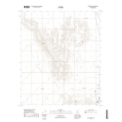
2018 Map of Childs Mountain
USGS Topo · Published 2018About this map
Childs Mtn dominates this Pima County landscape, serving as a central massif that separates the broad expanse of Childs Valley to the north from the encroaching residential expansion of Ajo to the south. The settlement of Gibson is clearly established along the southern margin, where the residential street grid meets the rugged foothills of the Little Ajo Mountains. This 2018 survey reveals the organized development patterns of the region, specifically how roads like W Snyder Rd and W Rasmussen Rd terminate abruptly at the topographical transition. Hydrological features such as Tenmile Wash in the northeast and Gibson Arroyo in the south define the seasonal drainage patterns typical of this arid environment, while the cadastral boundaries of T11S and T12S provide the legal framework for the land's ongoing use and management.
Find a feature on this map
22 named features on this map. Tap any name to fly to it.
Don’t see what you’re looking for? This feature index may not catch every label — zoom into the map to look around manually.
Map Details
Editions of this 2018 Childs Mountain Map
This is the sole edition of this map. No revisions or reprints were ever made.
Other maps of this area

1932 · Ajo
USGS Topo · 1:62,500

1934 · Ajo
USGS Topo · 1:62,500

1953 · Ajo
USGS Topo · 1:250,000

1957 · Ajo
USGS Topo · 1:250,000

1958 · Ajo
USGS Topo · 1:250,000

1958 · Midway
USGS Topo · 1:62,500

1962 · Ajo
USGS Topo · 1:250,000

1963 · Ajo
USGS Topo · 1:250,000

1963 · Ajo
USGS Topo · 1:62,500

1964 · Growler Peak
USGS Topo · 1:62,500