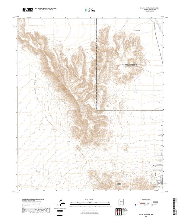
2021 Map of Childs Mountain
USGS Topo · Published 2021About this map
Childs Mtn dominates the central landscape of this Pima County region, rising sharply between the Childs Valley and the Valley of the Ajo. This modern survey by the U.S. Geological Survey captures the topographic transition from the high desert peaks to the established residential grids of Ajo and Gibson in the southeastern corner. The map reveals the relationship between the natural drainage of Tenmile Wash and Gibson Arroyo and the local road network, which includes several residential thoroughfares like W McMahon Rd and Rosedale Ave. In the southern portion of the sheet, the outliers of the Little Ajo Mountains stand as a geological gate to the desert settlements, providing a clear picture of how the community of Ajo has developed at the base of these distinctive southern Arizona mountain ranges.
Find a feature on this map
21 named features on this map. Tap any name to fly to it.
Don’t see what you’re looking for? This feature index may not catch every label — zoom into the map to look around manually.
Map Details
Editions of this 2021 Childs Mountain Map
This is the sole edition of this map. No revisions or reprints were ever made.
Other maps of this area

1932 · Ajo
USGS Topo · 1:62,500

1934 · Ajo
USGS Topo · 1:62,500

1953 · Ajo
USGS Topo · 1:250,000

1957 · Ajo
USGS Topo · 1:250,000

1958 · Ajo
USGS Topo · 1:250,000

1958 · Midway
USGS Topo · 1:62,500

1962 · Ajo
USGS Topo · 1:250,000

1963 · Ajo
USGS Topo · 1:250,000

1963 · Ajo
USGS Topo · 1:62,500

1964 · Growler Peak
USGS Topo · 1:62,500