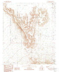
1990 Map of Childs Mountain
USGS Topo · Published 1991About this map
Childs Mountain dominates this landscape on the edge of the Barry M Goldwater Air Force Range, where military and conservation boundaries intersect. The 1990 survey captures a region defined by its isolation and specialized land use, containing the vast Cabeza Prieta National Wildlife Refuge. While the terrain is primarily open desert and peaks, human activity is marked by a remote Radio Facility and scattered infrastructure such as a Water Tank and Gravel Pit.
Find a feature on this map
21 named features on this map. Tap any name to fly to it.
Don’t see what you’re looking for? This feature index may not catch every label — zoom into the map to look around manually.
Map Details
Editions of this 1990 Childs Mountain Map
This is the sole edition of this map. No revisions or reprints were ever made.
Other maps of this area

1932 · Ajo
USGS Topo · 1:62,500

1934 · Ajo
USGS Topo · 1:62,500

1953 · Ajo
USGS Topo · 1:250,000

1957 · Ajo
USGS Topo · 1:250,000

1958 · Ajo
USGS Topo · 1:250,000

1958 · Midway
USGS Topo · 1:62,500

1962 · Ajo
USGS Topo · 1:250,000

1963 · Ajo
USGS Topo · 1:250,000

1963 · Ajo
USGS Topo · 1:62,500

1964 · Growler Peak
USGS Topo · 1:62,500