
1920 Map of Childwold
USGS Topo · Published 1954About this map
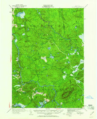
Childwold and Gale serve as the primary anchors of this 1920 survey, situated in the southern Adirondacks during an era defined by a transition from logging to seasonal recreation. The Raquette River winds through the western landscape, marked by significant water features such as Jamestown Falls and Moody Falls, reflecting the importance of river travel and hydrography in the St. Lawrence County interior. Remote camps such as Augerhole Camp and Wolf Pond Camp are scattered across the terrain, indicating a landscape heavily utilized for timber and sporting.
Find a feature on this map
90 named features on this map. Tap any name to fly to it.
Don’t see what you’re looking for? This feature index may not catch every label — zoom into the map to look around manually.
Map Details
Editions of this 1920 Childwold Map
2 editions found
Other maps of this area

1904 · Long Lake
USGS Topo · 1:62,500

1905 · Saint Regis
USGS Topo · 1:62,500

1907 · Tupper Lake
USGS Topo · 1:62,500

1908 · Potsdam
USGS Topo · 1:62,500

1919 · Nicholville
USGS Topo · 1:62,500

1919 · Cranberry Lake
USGS Topo · 1:62,500

1921 · Cranberry Lake
USGS Topo · 1:62,500

1921 · Childwold
USGS Topo · 1:48,000

1921 · Nicholville
USGS Topo · 1:62,500

1921 · Stark
USGS Topo · 1:62,500