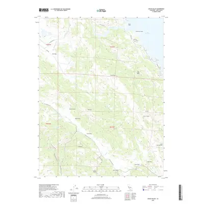
2018 Map of Chiles Valley
USGS Topo · Published 2018About this map
Pope Valley and Chiles Valley anchor this topographical survey of Napa County's rugged eastern interior, where the landscape is defined by a series of parallel ridges and narrow basins. The western edge of Lake Berryessa dominates the northeast corner, featuring Indian Island and Schoolhouse Island just offshore from Knoxville Rd. The terrain is marked by significant elevation changes, from the prominent Gregg Mtn and Baldy Mtn to the deeply carved Husman Canyon and Wood Canyon. Geologic and water features are abundant, including Soda Spring and Johnson Spring, along with evidence of industrial activity at Quarry Canyon. This 2018 edition provides a detailed view of the rural road network and trails such as the Valentine Vista Trail that navigate the slopes of Trout Creek Ridge and the Cedar Roughs wilderness area.
Find a feature on this map
44 named features on this map. Tap any name to fly to it.
Don’t see what you’re looking for? This feature index may not catch every label — zoom into the map to look around manually.
Map Details
Editions of this 2018 Chiles Valley Map
This is the sole edition of this map. No revisions or reprints were ever made.
Other maps of this area

1902 · Napa
USGS Topo · 1:125,000

1921 · Mt. Vaca
USGS Topo · 1:62,500

1924 · Capay
USGS Topo · 1:62,500

1942 · Sonoma
USGS Topo · 1:62,500

1942 · Mt. Vaca
USGS Topo · 1:62,500

1942 · St. Helena
USGS Topo · 1:62,500

1943 · Capay
USGS Topo · 1:62,500

1945 · Capay
USGS Topo · 1:62,500

1945 · St. Helena
USGS Topo · 1:62,500

1947 · Santa Rosa
USGS Topo · 1:250,000