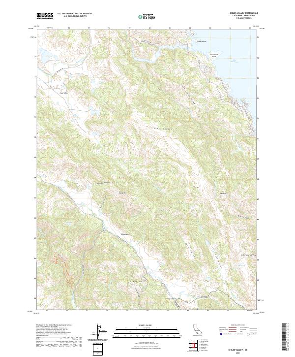
2021 Map of Chiles Valley
USGS Topo · Published 2021About this map
Pope Valley serves as a primary reference point in this corner of Napa County, where the landscape is defined by the drainage basins of the California Coast Ranges. The map captures the western shoreline of Lake Berryessa, featuring Indian Island and Schoolhouse Island at the mouth of Pope Creek. This modern survey illustrates how topographic features like Trout Creek Ridge and the Cedar Roughs separate the distinct agricultural and viticultural corridors of Chiles Valley, Elder Valley, and Soda Valley. Water resources are central to the area's geography, noted through numerous drainages such as Chiles Cr and Soda Cr, as well as localized features like Johnson Spring and Soda Spring. The terrain rises sharply toward prominent landmarks including Baldy Mtn and Little Sugarloaf Peak, showing the complex relief that dictates the path of thoroughfares like Chiles Pope Valley Rd and Sage Canyon Rd.
Find a feature on this map
46 named features on this map. Tap any name to fly to it.
Don’t see what you’re looking for? This feature index may not catch every label — zoom into the map to look around manually.
Map Details
Editions of this 2021 Chiles Valley Map
This is the sole edition of this map. No revisions or reprints were ever made.
Other maps of this area

1902 · Napa
USGS Topo · 1:125,000

1921 · Mt. Vaca
USGS Topo · 1:62,500

1924 · Capay
USGS Topo · 1:62,500

1942 · Sonoma
USGS Topo · 1:62,500

1942 · Mt. Vaca
USGS Topo · 1:62,500

1942 · St. Helena
USGS Topo · 1:62,500

1943 · Capay
USGS Topo · 1:62,500

1945 · Capay
USGS Topo · 1:62,500

1945 · St. Helena
USGS Topo · 1:62,500

1947 · Santa Rosa
USGS Topo · 1:250,000