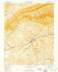
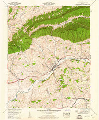
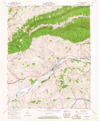
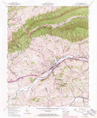
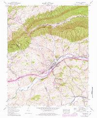
1958 Map of Chilhowie
USGS Topo · Published 1960About this map
The Middle Fork Holston River corridor in Smyth County serves as the primary artery for transport and commerce in this 1958 survey, anchored by the settlement of Chilhowie. The Norfolk and Western railway and the Lee Highway parallel the river, connecting historic crossroads like Seven Mile Ford and Fleet. The map captures an era of established rural community life, marked by a high density of family-named cemeteries such as Beattie and Farris, alongside rural institutions like the Cleghorn Valley School and Washington Springs Church. To the north, the terrain transitions into the steep ridges of Walker Mountain and Brushy Mountain, where landmarks like Goat Knob and Mollies Knob overlook narrow valleys. This topography dictated a settlement pattern where homes and churches, including Tate Chapel, were clustered near life-sustaining waters like McHenry Creek and Sulphur Spring Creek.
Find a feature on this map
71 named features on this map. Tap any name to fly to it.
Don’t see what you’re looking for? This feature index may not catch every label — zoom into the map to look around manually.
Map Details
Editions of this 1958 Chilhowie Map
5 editions found
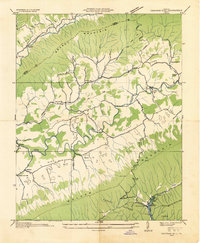
Other maps of this area

1891 · Abingdon
USGS Topo · 1:125,000

1894 · Abingdon
USGS Topo · 1:125,000

1909 · Abingdon
USGS Topo · 1:96,000

1911 · Abingdon
USGS Topo · 1:125,000
1934 · Chatham Hill
USGS Topo · 1:24,000

1935 · Konnarock
USGS Topo · 1:24,000

1935 · Chilhowie
USGS Topo · 1:24,000

1935 · Maccrady
USGS Topo · 1:24,000

1935 · Mount Rogers
USGS Topo · 1:48,000

1935 · Saltville
USGS Topo · 1:24,000