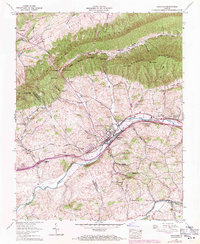
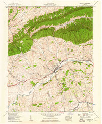
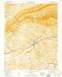
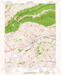
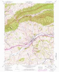
1958 Map of Chilhowie
USGS Topo · Published 1971About this map
Chilhowie serves as the central hub of this Appalachian landscape, where the Norfolk and Western railway and Lee Highway parallel the course of the Middle Fork Holston River. This corridor shows a dense pattern of settlement and industry, including the Chilhowie Beacon and the Huff Airport south of town. The map reveals a complex web of family lineage and local history through numerous burial grounds like Aspenvale Cem, Greever Cem, and Parris Cem, often situated near rural congregations such as Washington Springs Church and Campbells Chapel.
Find a feature on this map
57 named features on this map. Tap any name to fly to it.
Don’t see what you’re looking for? This feature index may not catch every label — zoom into the map to look around manually.
Map Details
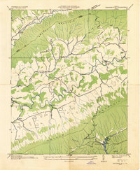
Editions of this 1958 Chilhowie Map
5 editions found
Other maps of this area

1891 · Abingdon
USGS Topo · 1:125,000

1894 · Abingdon
USGS Topo · 1:125,000

1909 · Abingdon
USGS Topo · 1:96,000

1911 · Abingdon
USGS Topo · 1:125,000
1934 · Chatham Hill
USGS Topo · 1:24,000

1935 · Konnarock
USGS Topo · 1:24,000

1935 · Chilhowie
USGS Topo · 1:24,000

1935 · Maccrady
USGS Topo · 1:24,000

1935 · Mount Rogers
USGS Topo · 1:48,000

1935 · Saltville
USGS Topo · 1:24,000