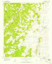
1954 Map of Chilili
USGS Topo · Published 1958About this map
Chilili Grant dominates the central landscape of this 1954 survey, preserving the legacy of a Spanish land grant at the foot of the Manzano Mountains. The settlement pattern reflects a deeply rooted ranching culture, with family-named outposts such as Ballinger Ranch, Dunn Place, and Thompson Place scattered across the high terrain. The distinction between Old Chilili and the more modern Chilili provides a clear view of how this mountain community evolved over generations. The arid landscape is defined by its drainages, including the Arroyo de Chilili and Arroyo de Gallegos, which dictated the location of vital infrastructure. Numerous windmills, such as Windmill 6612 and Windmill 6564, are meticulously marked, indicating the essential role of groundwater for the survival of these high-altitude ranching operations during the mid-20th century.
Find a feature on this map
29 named features on this map. Tap any name to fly to it.
Don’t see what you’re looking for? This feature index may not catch every label — zoom into the map to look around manually.
Map Details
Editions of this 1954 Chilili Map
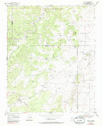
Other maps of this area

1892 · San Pedro
USGS Topo · 1:125,000

1917 · Estancia
USGS Topo · 1:125,000

1954 · Chilili
USGS Topo · 1:24,000

1954 · Sedillo
USGS Topo · 1:24,000

1954 · Tajique
USGS Topo · 1:24,000

1954 · Escabosa
USGS Topo · 1:24,000

1954 · Edgewood
USGS Topo · 1:24,000

1954 · Milbourn Ranch
USGS Topo · 1:24,000

1954 · Socorro
USGS Topo · 1:250,000

1956 · Edgewood
USGS Topo · 1:62,500