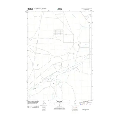
2010 Map of Chilly Buttes
USGS Topo · Published 2010About this map
The Chilly settlement and its surrounding agricultural valley are defined by the hydraulic engineering of the Chilly Canal, which diverts water across the landscape east of the Big Lost River. This 2010 survey illustrates a high-altitude ranching environment where water management is paramount, evidenced by the network of named drainages like Sage Creek, Thousand Springs Creek, and Bartlett Creek that feed into the river system. The terrain is punctuated by distinctive volcanic or erosional features such as Chilly Buttes and Swensen Butte, which provide vertical relief against the valley floor. For local historians, the Chilly Cemetery remains a central landmark for the community, while the Big Lost River Upper Access Area indicates the region's importance for modern riparian management and recreation. The road network, including Trail Creek Rd and Peck Canyon Rd, follows the natural contours of the canyons and the flatlands of Anderson Flat Rd.
Find a feature on this map
27 named features on this map. Tap any name to fly to it.
Don’t see what you’re looking for? This feature index may not catch every label — zoom into the map to look around manually.
Map Details
Editions of this 2010 Chilly Buttes Map
This is the sole edition of this map. No revisions or reprints were ever made.
Other maps of this area

1895 · Hailey
USGS Topo · 1:125,000

1897 · Hailey
USGS Topo · 1:125,000

1929 · Bayhorse
USGS Topo · 1:125,000

1935 · MacKay
USGS Topo · 1:96,000

1935 · Borah Peak
USGS Topo · 1:125,000

1938 · Borah Peak
USGS Topo · 1:125,000

1955 · Dubois
USGS Topo · 1:250,000

1955 · Idaho Falls
USGS Topo · 1:250,000

1955 · Hailey
USGS Topo · 1:250,000

1957 · Challis
USGS Topo · 1:250,000