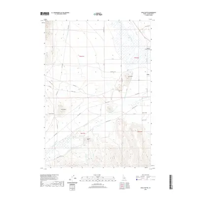
2020 Map of Chilly Buttes
USGS Topo · Published 2020About this map
Thousand Springs Valley defines this high-altitude landscape in central Idaho, where the Big Lost River winds through a basin flanked by prominent landmarks like Chilly Buttes and Swensen Butte. The settlement of Chilly remains a central point of human interest, accompanied by the nearby Chilly Cem. Water management is evident through features such as the Chilly Canal and numerous creeks, including Sage Cr and Thousand Springs Cr, which feed into the primary river system. The terrain transitions from the alluvial Barton Flats to the more varied topography around Bartlett Point and Swensen Basin. A network of local roads, such as Trail Creek Rd and Old Chilly Rd, connects these dispersed features, reflecting the enduring rural character and ranching heritage of Custer County.
Find a feature on this map
33 named features on this map. Tap any name to fly to it.
Don’t see what you’re looking for? This feature index may not catch every label — zoom into the map to look around manually.
Map Details
Editions of this 2020 Chilly Buttes Map
This is the sole edition of this map. No revisions or reprints were ever made.
Other maps of this area

1895 · Hailey
USGS Topo · 1:125,000

1897 · Hailey
USGS Topo · 1:125,000

1929 · Bayhorse
USGS Topo · 1:125,000

1935 · MacKay
USGS Topo · 1:96,000

1935 · Borah Peak
USGS Topo · 1:125,000

1938 · Borah Peak
USGS Topo · 1:125,000

1955 · Dubois
USGS Topo · 1:250,000

1955 · Idaho Falls
USGS Topo · 1:250,000

1955 · Hailey
USGS Topo · 1:250,000

1957 · Challis
USGS Topo · 1:250,000