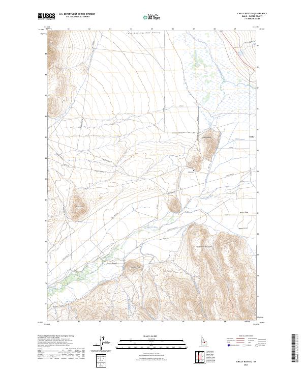
2023 Map of Chilly Buttes
USGS Topo · Published 2023About this map
Chilly sits at the eastern edge of a high-altitude basin where the Thousand Springs Valley meets the lower slopes of the White Knob Mountains. This 2023 edition documents a landscape defined by water management and topography, where the Big Lost River and its tributaries like Grant Creek and Talman Creek are essential to the agrarian footprint on Barton Flats. The presence of the Chilly Canal illustrates the long-standing reliance on irrigation to support life and industry in this part of Custer County.
Find a feature on this map
33 named features on this map. Tap any name to fly to it.
Don’t see what you’re looking for? This feature index may not catch every label — zoom into the map to look around manually.
Map Details
Editions of this 2023 Chilly Buttes Map
This is the sole edition of this map. No revisions or reprints were ever made.
Other maps of this area

1895 · Hailey
USGS Topo · 1:125,000

1897 · Hailey
USGS Topo · 1:125,000

1929 · Bayhorse
USGS Topo · 1:125,000

1935 · MacKay
USGS Topo · 1:96,000

1935 · Borah Peak
USGS Topo · 1:125,000

1938 · Borah Peak
USGS Topo · 1:125,000

1955 · Dubois
USGS Topo · 1:250,000

1955 · Idaho Falls
USGS Topo · 1:250,000

1955 · Hailey
USGS Topo · 1:250,000

1957 · Challis
USGS Topo · 1:250,000