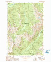
1990 Map of Chimney Peak
USGS Topo · Published 1990About this map
Olympic National Park defines this landscape of the high Olympics, where the headwaters of major river systems originate from steep glacial drainages. The map centers on the dramatic terrain surrounding Chimney Peak, a focal point between the Elwha River flowing north and the Upper Quinault River trending southwest. This topographic study, based on 1985 photography, illustrates the remote character of the interior park wilderness before modern digital mapping, highlighting the vital role of the Enchanted Valley Ranger Station as a primary backcountry outpost. The network of drainages including Hayes River, Godkin Creek, and Buckinghorse Creek reveals the complex hydrology of the range, with narrow valleys like Enchanted Valley serving as key corridors through the high peaks. The presence of Crystal Peak and O'Neil Peak underscores the verticality of the terrain, providing essential detail for researchers of Olympic Peninsula geography and wilderness management.
Find a feature on this map
20 named features on this map. Tap any name to fly to it.
Don’t see what you’re looking for? This feature index may not catch every label — zoom into the map to look around manually.
Map Details
Editions of this 1990 Chimney Peak Map
This is the sole edition of this map. No revisions or reprints were ever made.
Other maps of this area

1935 · Mount Olympus
USGS Topo · 1:62,500

1938 · Mt Constance
USGS Topo · 1:125,000

1942 · Mount Olympus
USGS Topo · 1:62,500

1944 · Mt. Angeles
USGS Topo · 1:62,500

1946 · Mt. Angeles
USGS Topo · 1:62,500

1947 · Mt. Steel
USGS Topo · 1:62,500

1947 · Mt Christie
USGS Topo · 1:62,500

1950 · Mt Christie
USGS Topo · 1:62,500

1950 · Mt. Steel
USGS Topo · 1:62,500

1956 · Mount Olympus
USGS Topo · 1:62,500