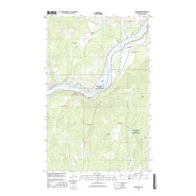
2017 Map of China Bend
USGS Topo · Published 2017About this map
Franklin D Roosevelt Lake dominates this portion of the Columbia River valley in Stevens County, where the river bends sharply between the settlements of Marble and China Bend. This area of the Colville National Forest vicinity is characterized by significant topographical relief, rising from the riverbanks to Lookout Mtn and O'Toole Mtn. Local infrastructure is shaped by the river and its tributaries, such as Crown Cr and Flat Cr, which have carved deep drainages into the surrounding mountains. The presence of the Crown Creek Ranch Airport and various way-stations like Ryan and China Bar indicates a landscape that balances recreational access with rural residency. Protected areas like the Lake Roosevelt National Recreation Area and the Phalon Lake Public Fishing Area highlight the region's importance for water-based activities and public land management in the modern era.
Find a feature on this map
50 named features on this map. Tap any name to fly to it.
Don’t see what you’re looking for? This feature index may not catch every label — zoom into the map to look around manually.
Map Details
Editions of this 2017 China Bend Map
This is the sole edition of this map. No revisions or reprints were ever made.
Other maps of this area

1929 · Colville
USGS Topo · 1:125,000

1933 · Colville
USGS Topo · 1:125,000

1936 · Marcus
USGS Topo · 1:96,000

1942 · Marcus
USGS Topo · 1:125,000

1948 · Kettle Falls
USGS Topo · 1:62,500

1948 · Orient
USGS Topo · 1:62,500

1951 · Orient
USGS Topo · 1:62,500

1951 · Kettle Falls
USGS Topo · 1:62,500

1952 · Gillette Mtn
USGS Topo · 1:24,000

1952 · Echo Valley
USGS Topo · 1:24,000