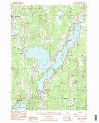
1983 Map of China Lake
USGS Topo · Published 1983About this map
China Lake serves as the central anchor for this part of Kennebec County, with the villages of China, South China, and East Vassalboro clustered along its irregular shoreline. The 1983 landscape reflects a long-established community, visible through an extensive network of family and community burial grounds such as Morrell Cem, Dudley Cem, and the China Village Cem Extension. Education and faith are anchored at sites like China Sch, St Peters Chapel, and the Friend Ch near Dirigo Corner.
Find a feature on this map
54 named features on this map. Tap any name to fly to it.
Don’t see what you’re looking for? This feature index may not catch every label — zoom into the map to look around manually.
Map Details
Editions of this 1983 China Lake Map
2 editions found
Other maps of this area

1892 · Waterville
USGS Topo · 1:62,500

1893 · Vassalboro
USGS Topo · 1:62,500

1898 · Vassalboro
USGS Topo · 1:62,500

1916 · Liberty
USGS Topo · 1:62,500

1926 · Burnham
USGS Topo · 1:62,500

1941 · Vassalboro
USGS Topo · 1:62,500

1942 · Liberty
USGS Topo · 1:62,500

1943 · Vassalboro
USGS Topo · 1:62,500

1943 · Waterville
USGS Topo · 1:62,500

1948 · Bangor
USGS Topo · 1:250,000