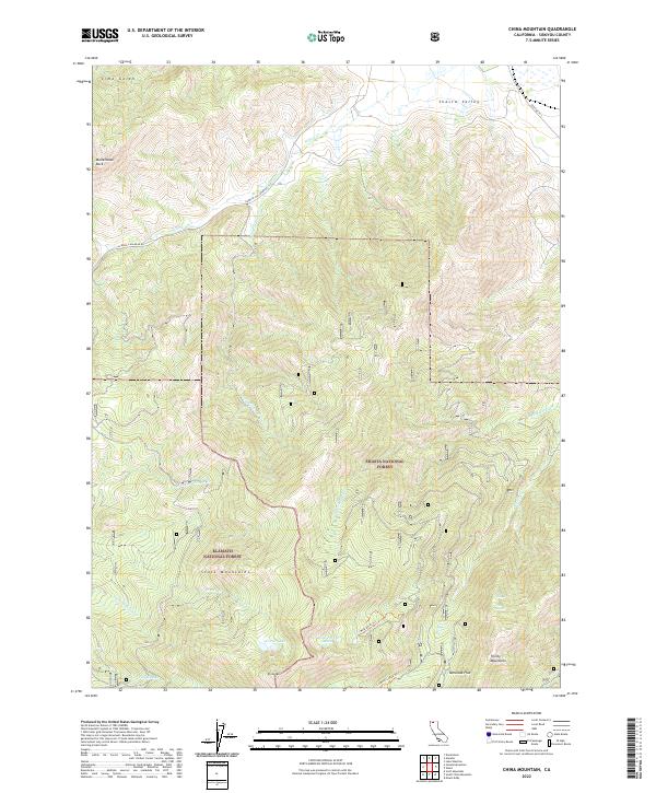
2022 Map of China Mountain
USGS Topo · Published 2022About this map
China Mtn stands at the convergence of the Scott Mountains and the Trinity Mountains in this modern survey of the high Siskiyou country. This high-altitude landscape is defined by the hydrologic divide between the Shasta Valley to the north and the deep basins containing Crater Lake and the West Park Lakes to the south. Historically significant routes like the Gazelle Callahan Rd and Old Hwy 99 S skirt the periphery of these peaks, while the interior is accessed only by primitive paths like the Caldwell Lakes Trl and West Parks Trl. The map illustrates the administrative division between the Klamath National Forest and Shasta National Forest, preserving a wilderness character marked by landmarks such as Mallethead Rock and the high meadow of Tamarack Flat.
Find a feature on this map
27 named features on this map. Tap any name to fly to it.
Don’t see what you’re looking for? This feature index may not catch every label — zoom into the map to look around manually.
Map Details
Editions of this 2022 China Mountain Map
This is the sole edition of this map. No revisions or reprints were ever made.
Other maps of this area

1886 · Shasta
USGS Topo · 1:250,000

1894 · Shasta
USGS Topo · 1:250,000

1921 · Shasta Valley Sheet No 7
USGS Topo · 1:24,000

1921 · Shasta Valley Sheet No 1
USGS Topo · 1:24,000

1922 · Shasta Valley Sheet No 1 S
USGS Topo · 1:24,000
1922 · Shasta Valley Sheet No 8
USGS Topo · 1:24,000

1923 · Sawyers Bar
USGS Topo · 1:125,000

1931 · Etna
USGS Topo · 1:96,000

1932 · Yreka
USGS Topo · 1:96,000

1934 · Etna
USGS Topo · 1:125,000