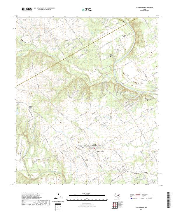
2022 Map of China Springs
USGS Topo · Published 2022About this map
The Brazos River and North Bosque River anchor this landscape northwest of Waco, where the rural character of McLennan County is defined by winding tributaries and established settlements. In the center, China Springs serves as a local hub, accompanied by the community of China Spring and the riverside development at Cougar Landing. The river geography is particularly complex at Wortham Bend, where the Brazos carves a deep loop across the Bosque and Hill County lines. This area reflects a long-standing pattern of settlement and burial, evidenced by several small family and community grounds including Wortham Bend Cem, Patrick Cem, and China Springs Cem. North of the river, Gholson sits near the eastern edge of the quadrangle, while the terrain transitions from the water-rich bottomlands to upland areas like Shadow Ridge. Small aviation landmarks such as Pocock Airport and Wildcat Canyon Airport point to the modern evolution of these traditional ranching and farming lands.
Find a feature on this map
134 named features on this map. Tap any name to fly to it.
Don’t see what you’re looking for? This feature index may not catch every label — zoom into the map to look around manually.
Map Details
Editions of this 2022 China Springs Map
This is the sole edition of this map. No revisions or reprints were ever made.
Other maps of this area

1892 · Waco
USGS Topo · 1:125,000

1920 · Waco
USGS Topo · 1:125,000

1924 · Waco 4-c
USGS Topo · 1:48,000

1924 · Waco 3-d
USGS Topo · 1:48,000

1931 · Whitney
USGS Topo · 1:62,500

1931 · Valley Mills
USGS Topo · 1:62,500

1931 · Elm Mott
USGS Topo · 1:62,500

1954 · Waco
USGS Topo · 1:250,000

1955 · Waco
USGS Topo · 1:250,000
1957 · Aquilla
USGS Topo · 1:24,000