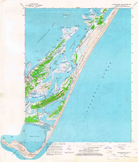
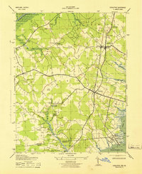
1965 Map of Chincoteague East
USGS Topo · Published 1966About this map
Chincoteague sits at the heart of this coastal survey, revealing a landscape defined by the complex channels and tidal flats of the Virginia coast in the mid-1960s. The town's grid is well-established, supported by community landmarks like the Chincoteague High Sch and the Christ Sanctified Holy Ch. Smaller settlements such as Birch Town and Sheepshead appear to the south, while Ridge Cem and Mechanics Cem offer significant genealogical data for the island's families.
Find a feature on this map
62 named features on this map. Tap any name to fly to it.
Don’t see what you’re looking for? This feature index may not catch every label — zoom into the map to look around manually.
Map Details
Editions of this 1965 Chincoteague East Map
4 editions found
Other maps of this area

1901 · Snow Hill
USGS Topo · 1:62,500

1901 · Green Run
USGS Topo · 1:62,500

1938 · Green Run
USGS Topo · 1:62,500

1942 · Chincoteague East
USGS Topo · 1:24,000

1942 · Wallops Island
USGS Topo · 1:24,000

1943 · Boxiron
USGS Topo · 1:31,680

1943 · Whittington Point
USGS Topo · 1:31,680

1943 · Chincoteague West
USGS Topo · 1:31,680
1943 · Girdletree
USGS Topo · 1:31,680

1943 · Wallops Island
USGS Topo · 1:31,680