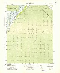
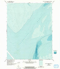
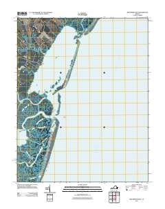
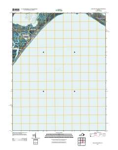
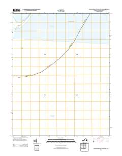
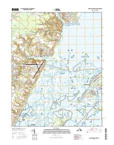
1965 Map of Chincoteague East
USGS Topo · Published 1981About this map
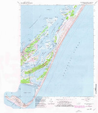
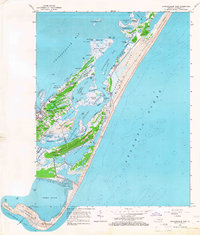
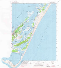
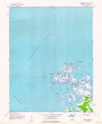
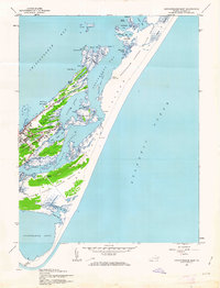
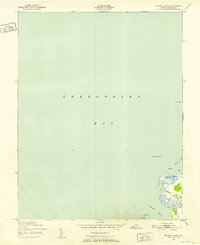
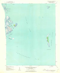
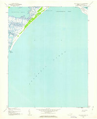
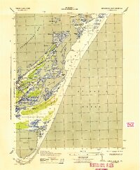
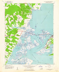
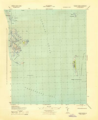
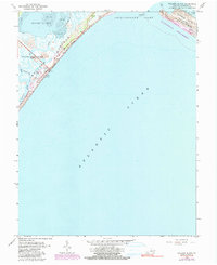
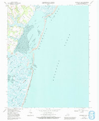
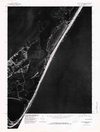
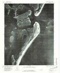
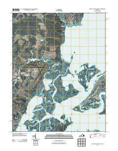
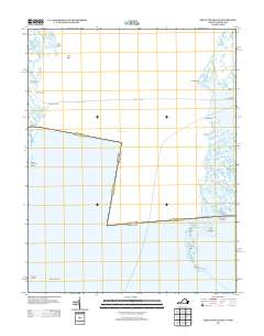
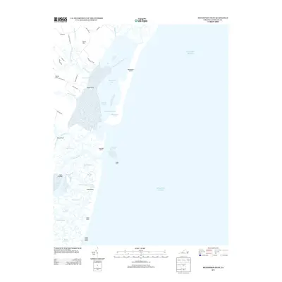
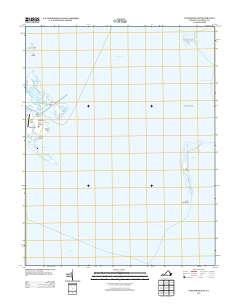
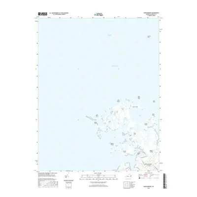
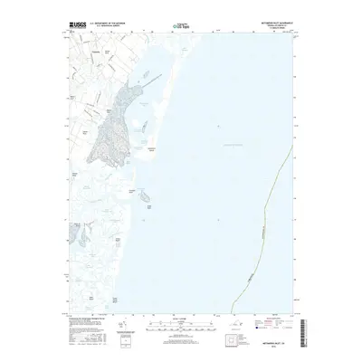
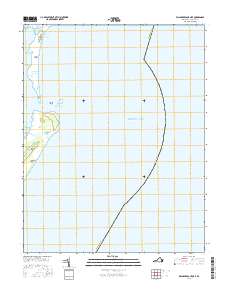
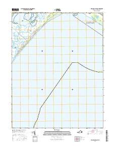
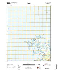
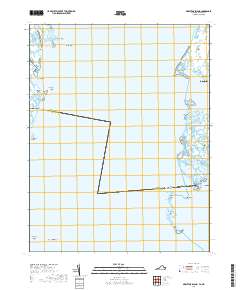
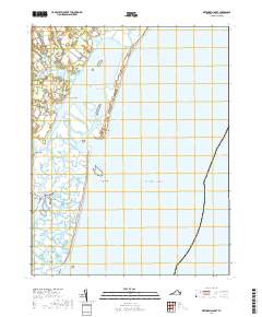
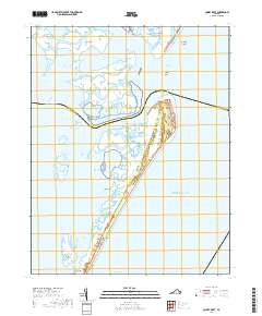
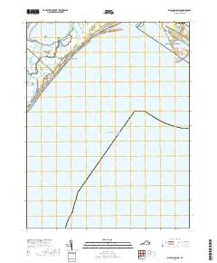
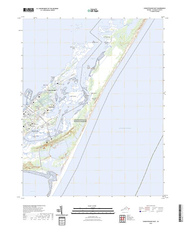
Chincoteague and the nearby settlement of Birch Town dominate the landscape of Chincoteague Island in this mid-1960s survey, showing a community defined by its maritime surroundings and conservation boundaries. The map detail highlights the established religious and civic life of the area, featuring the Christ Sanctified Holy Ch, Chincoteague High Sch, and several community burial grounds including Redman Cem and Mechanics Cem. To the east, across the Assateague Channel, the expanse of the Chincoteague National Wildlife Refuge and Assateague Island National Seashore is marked by tidal flats, marshlands, and a Jeep Trail along the coast. The presence of the Assateague Beach U S Coast Guard Station and a Lookout Tower near Fishing Point reflects the critical importance of coastal monitoring at this southern end of the barrier island system.
Find a feature on this map
62 named features on this map. Tap any name to fly to it.
Don’t see what you’re looking for? This feature index may not catch every label — zoom into the map to look around manually.
Map Details
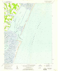
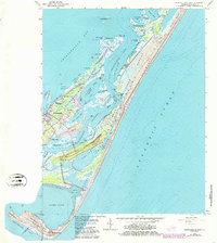
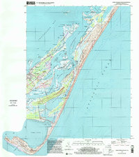
Editions of this 1965 Chincoteague East Map
4 editions found
Historical Maps of Chincoteague Through Time
101 maps found
1917 Ewell
Accomack County, VA
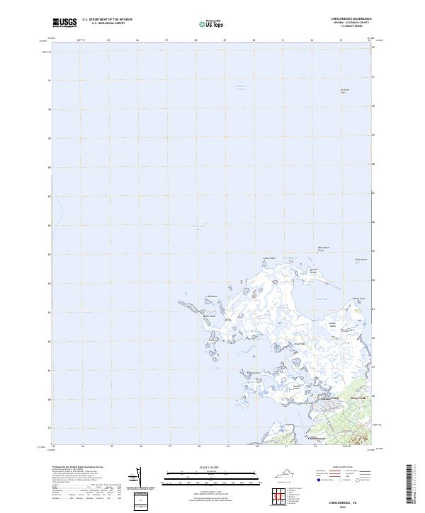
1942 Chesconessex
Accomack County, VA
1942 Chincoteague East
Accomack County, VA

1942 Ewell
Accomack County, VA

1942 Little Machipongo Inlet
Accomack County, VA
1942 Nandua Creek
Accomack County, VA
1942 Tangier Island
Accomack County, VA
1942 Wallops Island
Accomack County, VA
1943 Chincoteague East
Accomack County, VA
1943 Chincoteague West
Accomack County, VA
1943 Tangier Island
Accomack County, VA
1943 Wallops Island
Accomack County, VA
1957 Metomkin Inlet
Accomack County, VA
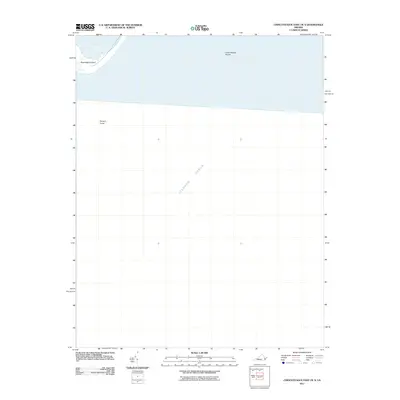
1965 Chincoteague East
Accomack County, VA
1965 Chincoteague West
Accomack County, VA
1965 Wallops Island
Accomack County, VA
1968 Chesconessex
Accomack County, VA
1968 Goose Island
Accomack County, VA
1968 Great Fox Island
Accomack County, VA
1968 Metompkin Inlet
Accomack County, VA
1968 Nandua Creek
Accomack County, VA
1968 Quinby Inlet
Accomack County, VA
1968 Tangier Island
Accomack County, VA
1978 Chincoteague East
Accomack County, VA
1978 Quinby Inlet
Accomack County, VA
1986 East of Fleets Bay
Accomack County, VA
1986 West of Jamesville
Accomack County, VA
1986 West of Nandua Creek
Accomack County, VA
1999 Chincoteague East
Accomack County, VA
2011 Chesconessex
Accomack County, VA
2011 Chincoteague East
Accomack County, VA
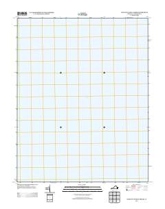
2011 Chincoteague East OE S
Accomack County, VA
2011 Chincoteague West
Accomack County, VA
2011 Goose Island
Accomack County, VA
2011 Great Fox Island
Accomack County, VA
2011 Metompkin Inlet
Accomack County, VA
2011 Nandua Creek
Accomack County, VA
2011 Quinby Inlet
Accomack County, VA
2011 Tangier Island
Accomack County, VA
2011 Wachapreague OE E
Accomack County, VA
2011 Wallops Island
Accomack County, VA
2013 Chesconessex
Accomack County, VA
2013 Chincoteague East
Accomack County, VA
2013 Chincoteague East OE S
Accomack County, VA
2013 Chincoteague West
Accomack County, VA
2013 East of Fleets Bay
Accomack County, VA
2013 Goose Island
Accomack County, VA
2013 Great Fox Island
Accomack County, VA
2013 Metompkin Inlet
Accomack County, VA
2013 Nandua Creek
Accomack County, VA
2013 Quinby Inlet
Accomack County, VA
2013 Tangier Island
Accomack County, VA
2013 Wachapreague OE E
Accomack County, VA
2013 Wallops Island
Accomack County, VA
2013 West of Jamesville
Accomack County, VA
2013 West of Nandua Creek
Accomack County, VA
2016 Chesconessex
Accomack County, VA
2016 Chincoteague East
Accomack County, VA
2016 Chincoteague East OE S
Accomack County, VA
2016 Chincoteague West
Accomack County, VA
2016 East of Fleets Bay
Accomack County, VA
2016 Goose Island
Accomack County, VA
2016 Great Fox Island
Accomack County, VA
2016 Metompkin Inlet
Accomack County, VA
2016 Nandua Creek
Accomack County, VA
2016 Quinby Inlet
Accomack County, VA
2016 Tangier Island
Accomack County, VA
2016 Wachapreague OE E
Accomack County, VA
2016 Wallops Island
Accomack County, VA
2016 West of Jamesville
Accomack County, VA
2016 West of Nandua Creek
Accomack County, VA
2019 Chesconessex
Accomack County, VA
2019 Chincoteague East
Accomack County, VA
2019 Chincoteague East OE S
Accomack County, VA
2019 Chincoteague West
Accomack County, VA
2019 East of Fleets Bay
Accomack County, VA
2019 Goose Island
Accomack County, VA
2019 Great Fox Island
Accomack County, VA
2019 Metompkin Inlet
Accomack County, VA
2019 Nandua Creek
Accomack County, VA
2019 Quinby Inlet
Accomack County, VA
2019 Tangier Island
Accomack County, VA
2019 Wachapreague OE E
Accomack County, VA
2019 Wallops Island
Accomack County, VA
2019 West of Jamesville
Accomack County, VA
2019 West of Nandua Creek
Accomack County, VA
2022 Chesconessex
Accomack County, VA
2022 Chincoteague East
Accomack County, VA
2022 Chincoteague East OE S
Accomack County, VA
2022 Chincoteague West
Accomack County, VA
2022 East of Fleets Bay
Accomack County, VA
2022 Goose Island
Accomack County, VA
2022 Great Fox Island
Accomack County, VA
2022 Metompkin Inlet
Accomack County, VA
2022 Nandua Creek
Accomack County, VA
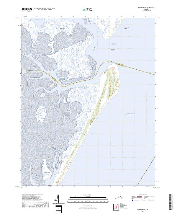
2022 Quinby Inlet
Accomack County, VA
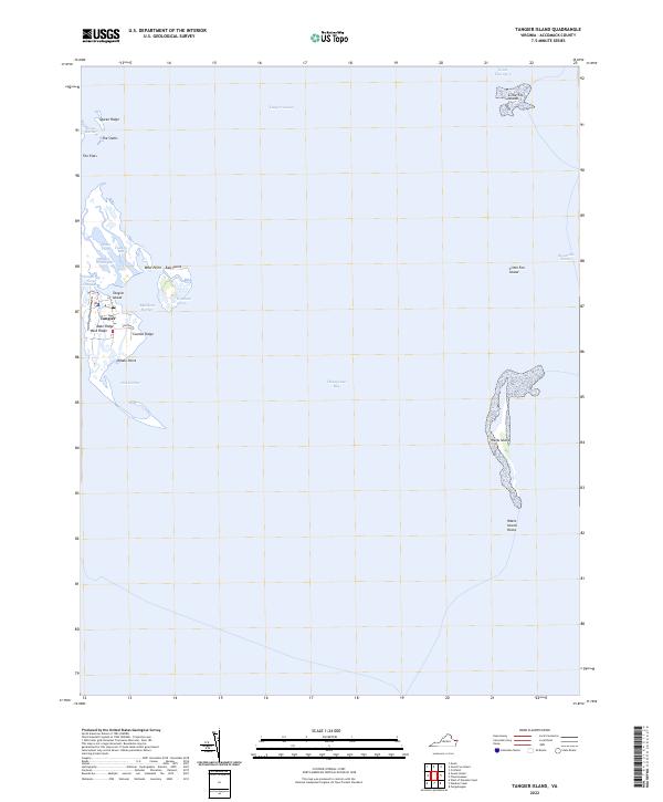
2022 Tangier Island
Accomack County, VA
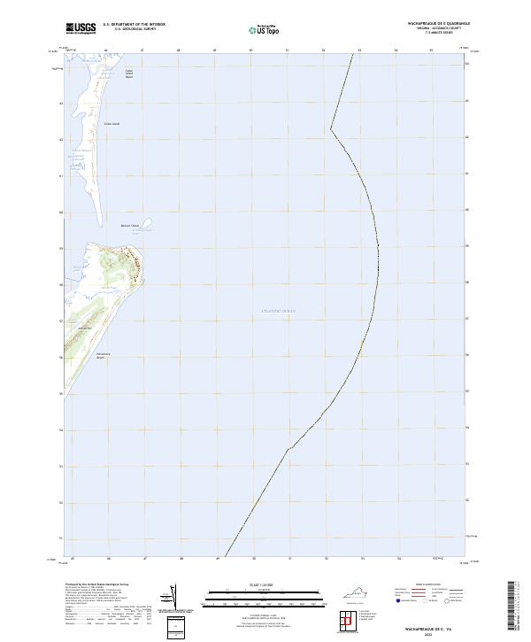
2022 Wachapreague OE E
Accomack County, VA
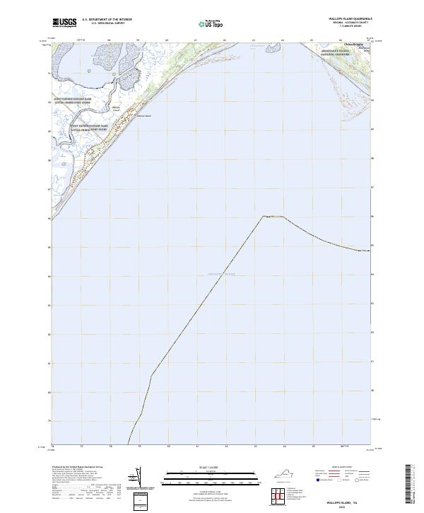
2022 Wallops Island
Accomack County, VA
2022 West of Jamesville
Accomack County, VA
2022 West of Nandua Creek
Accomack County, VA