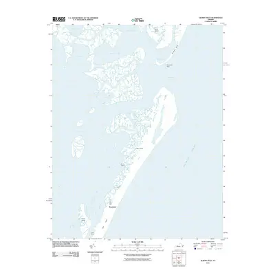
2011 Map of Quinby Inlet
USGS Topo · Published 2011About this map
Hog Island and its surrounding coastal marshes define this maritime landscape along the Virginia Eastern Shore. The settlement of Broadwater is positioned on the interior of the island, near the southern reach where the land narrows toward Cove Point. This environment is characterized by a complex network of tidal waterways and lagoons, including Sandy Island Bay, Tar Bay, and Black Duck Cove, which separate the barrier islands from the mainland. To the north, the passage at Quinby Inlet breaks the chain of islands between Parramore Island and the marshes of Stingaree Point. The presence of the Hog Island Light serves as a critical navigational marker for those traversing the adjacent Atlantic Ocean. The map provides a clear record of the shifting coastal geography of these dynamic barrier islands before the elements further alter their low-lying profiles.
Find a feature on this map
19 named features on this map. Tap any name to fly to it.
Don’t see what you’re looking for? This feature index may not catch every label — zoom into the map to look around manually.
Map Details
Editions of this 2011 Quinby Inlet Map
This is the sole edition of this map. No revisions or reprints were ever made.
Other maps of this area

1931 · Accomac
USGS Topo · 1:48,000

1935 · Accomac
USGS Topo · 1:62,500

1941 · Broadwater
USGS Topo · 1:62,500

1942 · Cobb Island
USGS Topo · 1:24,000

1942 · Great Machipongo Inlet
USGS Topo · 1:24,000

1942 · Little Machipongo Inlet
USGS Topo · 1:24,000

1942 · Nassawadox
USGS Topo · 1:24,000

1943 · Nassawadox
USGS Topo · 1:31,680

1943 · Exmore
USGS Topo · 1:24,000

1944 · Exmore
USGS Topo · 1:31,680