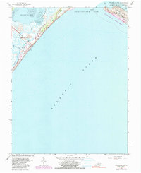
1965 Map of Wallops Island
USGS Topo · Published 1991About this map
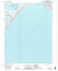
The Wallops Flight Center (NASA) dominates this coastal survey, highlighting the intersection of aerospace technology and the fragile barrier island ecosystem of the mid-1960s. Scientific infrastructure is scattered along the coast, including a Weather Station, Radio Towers, and multiple Launch Pads situated directly behind the Beach. This industrial presence contrasts sharply with the nearby protected landscapes of the Assateague Island National Seashore and the Chincoteague National Wildlife Refuge. The map details a complex hydrographic environment of tidal flats and winding channels like Island Hole Narrows and Cat Creek. Soundings in the Atlantic Ocean and Chincoteague Inlet provide depth data essential for navigating these shifting sands, while landmarks such as the Water Tank and Lookout Tower serve as points of reference for the early space program facilities.
Find a feature on this map
27 named features on this map. Tap any name to fly to it.
Don’t see what you’re looking for? This feature index may not catch every label — zoom into the map to look around manually.
Map Details
Editions of this 1965 Wallops Island Map
5 editions found
Other maps of this area

1931 · Accomac
USGS Topo · 1:48,000

1935 · Accomac
USGS Topo · 1:62,500

1942 · Chincoteague East
USGS Topo · 1:24,000

1942 · Mappsville
USGS Topo · 1:24,000

1942 · Wallops Island
USGS Topo · 1:24,000

1943 · Mappsville
USGS Topo · 1:31,680

1943 · Chincoteague West
USGS Topo · 1:31,680
1943 · Hallwood
USGS Topo · 1:31,680

1943 · Wallops Island
USGS Topo · 1:31,680
1943 · Chincoteague East
USGS Topo · 1:31,680