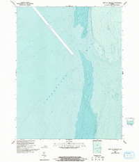
1986 Map of West of Jamesville
USGS Topo · Published 1993About this map
Chesapeake Bay dominates this bathymetric study, revealing the complex underwater topography west of Jamesville. Compiled by the National Ocean Service and the U.S. Geological Survey, the map focuses on the submerged landscape during the late 1980s and early 1990s. The most prominent navigational feature is a long, linear Channel cutting diagonally through the bay, likely a primary artery for maritime traffic. This map is distinct for its singular focus on depth gradients and seafloor contours rather than terrestrial landmarks. It provides researchers and maritime historians with a clear view of the deep-water trenches and shoals that dictated vessel movement along the Eastern Shore of Virginia during this period.
Find a feature on this map
2 named features on this map. Tap any name to fly to it.
Don’t see what you’re looking for? This feature index may not catch every label — zoom into the map to look around manually.
Map Details
Editions of this 1986 West of Jamesville Map
2 editions found
Other maps of this area

1942 · Nandua Creek
USGS Topo · 1:24,000

1943 · Jamesville
USGS Topo · 1:31,680

1943 · Franktown
USGS Topo · 1:31,680

1943 · Richmond
USGS Topo · 1:250,000

1946 · Eastville
USGS Topo · 1:250,000

1949 · Richmond
USGS Topo · 1:250,000

1959 · Richmond
USGS Topo · 1:250,000

1961 · Eastville
USGS Topo · 1:250,000

1964 · Richmond
USGS Topo · 1:250,000
1965 · Bethel Beach
USGS Topo · 1:24,000