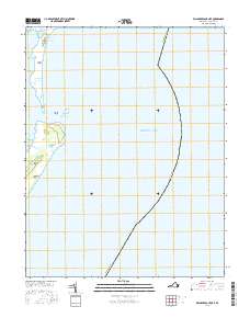
2016 Map of Wachapreague OE E
USGS Topo · Published 2016About this map
Cedar Island and Parramore Beach define the fragile barrier island landscape along the Virginia coastline in this maritime survey. Divided by the Wachapreague Inlet, these landforms separate the inner marsh channels from the open Atlantic Ocean. The western edge of the sheet is a complex network of tidal waterways including Brandywine Channel, Big Wye Channel, and Sloop Channel. These passages, along with features like Great Gut and Horseshoe Lead, illustrate the shifting hydrography of Accomack County. Further south, the map reveals landward features such as Italian Hill and the Goose Lakes, providing a detailed look at the interface between the Eastern Shore's barrier system and its interior lagoons.
Find a feature on this map
17 named features on this map. Tap any name to fly to it.
Don’t see what you’re looking for? This feature index may not catch every label — zoom into the map to look around manually.
Map Details
Editions of this 2016 Wachapreague OE E Map
This is the sole edition of this map. No revisions or reprints were ever made.
Other maps of this area

1931 · Accomac
USGS Topo · 1:48,000

1935 · Accomac
USGS Topo · 1:62,500

1941 · Broadwater
USGS Topo · 1:62,500

1942 · Little Machipongo Inlet
USGS Topo · 1:24,000

1946 · Eastville
USGS Topo · 1:250,000
1957 · Accomac
USGS Topo · 1:24,000
1957 · Metomkin Inlet
USGS Topo · 1:24,000

1961 · Eastville
USGS Topo · 1:250,000

1966 · Eastville
USGS Topo · 1:250,000
1968 · Accomac
USGS Topo · 1:24,000